Marloes Sands and Mere Hike
Sitting in the southwest corner of Wales is one of Britain's most beautiful coastal regions combining both stunning scenery and incredible wildlife.
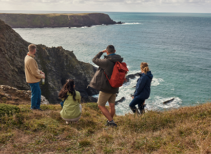
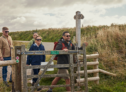
The Marloes landscape is a colourful combination of coast and countryside and a must see for any beach lovers, bird watchers or seal spotters. This circular route, looked after by the National Trust, takes you across wetlands, farmlands and across the Wales Coast Path.
Where is Marloes Sands?
Marloes Sands is a long stretch of sandy coastline in Pembrokeshire, Wales, near the village of Marloes. It’s a curved coastline surrounded by incredible cliffs with the beach located southwest of Marloes village.
How far is the hike?
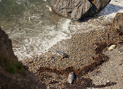
This is a beautiful circular route starting out at the National Trust car park, it takes around 2 hours and 12 minutes to complete a distance of 5.11 miles. If you’re planning a day spent wildlife spotting be sure to bring a camera because Marloes Sands is the perfect location and you’re almost guaranteed to see a wealth of nature including seals, seabirds and porpoises.
What to wear?
For a trip to Marloes Sands we would recommend being well prepared when it comes to kit. As beautiful as the location is, the weather can be changeable so a waterproof jacket waterproof jackets are a must. When walking along the cliffs the landscape is quite exposed so a fleece or light down compresslite is the perfect item to pack in your bag for when the wind gets up to keep you warm and comfortable.
GPX Route:
Need more details on the route? Below you’ll find our GPX route of the hike with information on length, elevation and accessibility.
Level: Intermediate
Distance: 5.11 miles
Elevation: 350ft